Upo Marsh is a remote and rural yet nevertheless accessible destination. It’s a large wetland, so I figured that the Upo Marsh circuit hike would take me all afternoon or longer.
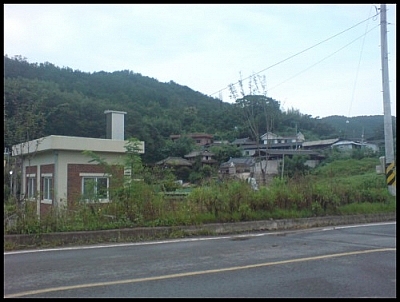
Located in Gyeongsangnam-do, near Changnyeong, it’s an easy hour-long bus ride from Busan‘s Seobu terminal. Travelling on my own, I arrived in Changnyeong around noon and quickly found the local bus terminal. Some of the bus drivers hanging about informed me of two different routes I could take to Upo. The first would drop me off directly at the wetland’s ecological exhibition hall; the other would let me off a two-kilometre walk away. Since the latter departed earlier, I opted to take the scenic route and was pleased by the rustic charm of the villages situated along the access road to Upo.
My goal was to walk around the circumference of the wetlands. At a cumulative area of 2,312,926 square kilometres, this was no small feat. The man at the information booth estimated that it would take five hours to complete the Upo Marsh circuit hike. I glanced at my watch: 14:30. The sun would set before I could return to the eco-centre and I would miss the last bus leaving from the centre back to Changnyeong. That was a problem I would deal with later.
After a brief tour of the exhibition hall, where I learned that Upo Wetland is a conglomeration of four marshes, of which Upo Marsh is the largest, I began my walking tour of the wetland area, first going east towards Daedae Bank.
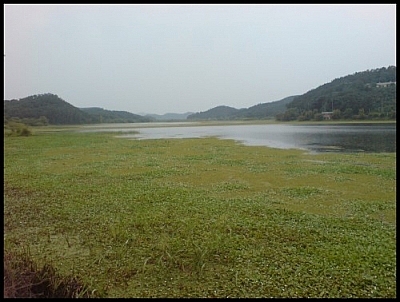
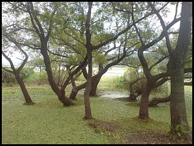
As I stepped onto the first of the four trails that would take me around the wetlands, I was struck by the vast beauty of Upo. Monsoon season having recently ended, the lush, verdant green before my eyes was abundant. The dullness of the grey, cloudy sky was incapable of dimming the vibrancy of the wetlands.
It wasn’t until after I’d gone about twenty minutes that I realized I was walking in the opposite direction from the dinosaur fossils that were found in the sedimentary rock layer of the marsh. I was curious to see the raindrop-patterned fossils, as well as those of dinosaur footprints and insects. I forged forward, a little chagrined knowing I would likely not see them.
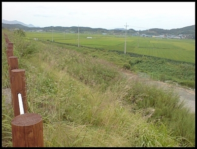
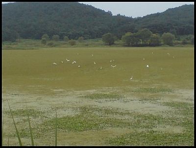
To my right as I crossed the Daedae Bank, large agricultural fields caught my eye. I was intrigued by the fact that a plethora of birds were congregating on the wetland but were avoiding the fields.
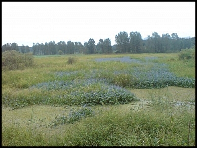
I turned onto Sajipo Bank, where I could see part of Sajipo Marsh. The brightest blue flowers clustered together towards the middle of the marsh, enveloped in the brown and green of the waters and surrounding vegetation.
As I strolled leisurely along through Jumae and Somok villages, it began to rain. Lightly at first, so I wasn’t bothered by it. I temporarily took refuge at a bus stop and chatted with a few local retirees. Braving the rain, I continued on my way. Soon, the drizzle rain began to strike harder upon my head. I regretted not having an umbrella. Miraculously it seems, a family of four sharing three umbrellas waved me over and gave me one of theirs. Expressing my profound gratitude as well as I could, I shortly entered at Somok village.
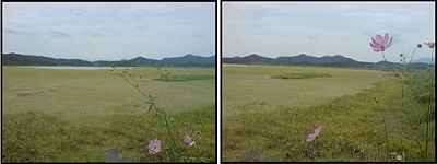
The path edging the wetlands had been paved since I’d began traversing the villages — I was the only pedestrian sharing the road with a few motorists and cyclists. Every few minutes, passengers would alight from their cars to take photos, and then carry on their sightseeing tour. The beauty of the scenery, the tranquility of the setting, and the avian life impressed themselves upon me.
Shortly after passing through Jangjae village, I climbed stairs leading up to another, smaller, bank and reached a bridge where local youths were fishing. I paused to admire the landscape — and to watch one young man pull a fish out of the water about fifteen feet to the bridge without ever reeling in. I crossed the bridge over Mokpo Marsh and rejoined the main path, happy for the shortcut. Two and a half hours had already passed.
The road was much lonelier on the western side of the wetland. I truly felt alone, communing with nature. The rain had stopped and many herons and white-plumed egrets were gliding and swooping over Mokpo Marsh. It was easy to understand why this place was registered with the Ramsar Convention in 1998 (an international treaty that promotes the conservation of wetlands). The downside to my solitude was that I could no longer ask for directions at confusing crossroads. All along, I’d had to rely on directions from locals to guide me as my tourist map was woefully inaccurate at times.
The moment finally came when the only person in the vicinity of an intersection was a tourist from Seoul. Far from where we deduced we were, the map showed a bank crossing between Zzokjibeol, Mokpo, and Upo Marshes. Before us, a bank. I decided to take a gamble and stepped onto the bank, leaving the road behind me.
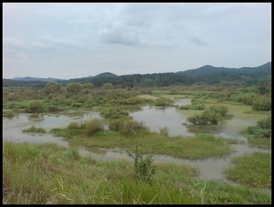
It appeared as though I was right. I skirted the south side of Zzokjibeol, the only of the four marshes to have retained its Korean name (the others are now known by their Chinese names). I could no longer see any egrets or herons flying about, though I observed some farmers finishing their day’s work at a relaxed pace.
Once I emerged, I realised that I would need to cross the river before regaining the trail; yet, as I walked along the road, I passed numerous small villages, several with a bus stop. After passing two or three bus stops, I recognised the name of a village I had seen earlier that day at the local bus terminal. Another look at my watch — thirty minutes to sundown.
I abandoned the trail to the eco-centre, effectively ending my Upo Marsh circuit hike, and followed the road for another thirty minutes, all the while alternately gazing at the numerous villages and the river that hugged the road. Topyeongcheon is a stream that empties into the Nakdong River; it in turn culminates in Busan, at Eulsuk Island and the Nakdong estuary — yet another wetland I’d visited a few months before. Both Upo Wetland and Eulsukdo are conservation areas for migratory birds. I pondered the significance of this as I recalled that both were formed at the same time by melting glaciers approximately 6,000 years ago.
Dusk had started to settle in when I reached a secondary highway and started to walk along it, trusting to luck that I was walking towards Changnyeong. Not long afterwards, a pickup truck pulled over and waved me into the front seat. The driver and I merrily attempted to converse, both using what little of the other’s language we possessed, until he dropped me off in Changnyeong after dark.
This photo journal of my Upo Marsh circuit hike was written as a volunteer for the Korea Wetland Project. In September, I went on a solo day trip exploring Upo Marsh, with the objective of writing a photo journal to attract more tourists to the eco-tours offered in all of Korea’s national parks. Check out my other photo journal for the Korea Wetland Project: Jirisan Wetland Eco-Tour.


Search Niackery
×