I mentioned after our six-day springtime trek that hiking the La Cloche Silhouette Trail would ideally take 17 days — and yep, that’s still true! Slow and steady with lots of time to relax and enjoy the surroundings… But that might be a little too long for some people.
Well, here are several itineraries for hiking the La Cloche Silhouette Trail that are sure to cover all the bases. Enjoy the trek!
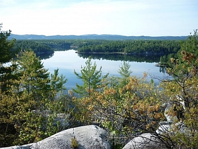
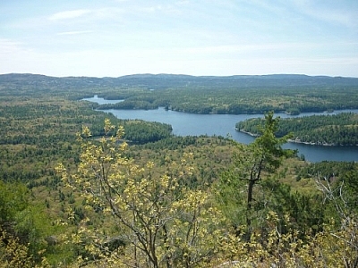
Hiking the La Cloche Silhouette Trail in 17 Days
It may seem counter-intuitive to start with the toughest trail sections and to schedule big ascents with a heavy pack, but towards the end of a long trek, a pack feels heavy no matter what, so it’s nice if the terrain is more level. For this reason, this route suggests hiking the La Cloche Silhouette Trail in a counterclockwise direction.


Day 2: H50 to H49 (or H48) — A seriously fun day with magnificent views, though climbing The Crack with a nearly full pack will be a challenge! (Total: 6.5 km)
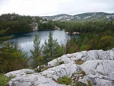
Day 3: REST — Little Superior Lake is bright blue, the area is lovely, and there’s a lot of wildlife hanging around. Proof: Read about the time I was stared down by a moose!
Day 4: H49 to H45 (or H46) — Another nice day with lots of small ascents and descents atop ridges, typical of most days hiking the La Cloche Silhouette Trail. Spend the night at woodsy Bunnyrabbit Lake. (Total: 5.7 km)
Day 5: H45 to H38 (or H37) — This is one of the shortest days of the trip, but with good reason. The sites at Silver Lake are quite nice, and as the name implies, you’re quite close to Silver Peak from here. A perfect spot to stop for a side trip… (Total: 4.9 km)
Day 6: REST — Relax some aching muscles and get ready for tomorrow’s big side trip!
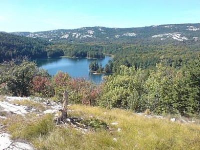
Day 8: H38 to H35 (or H34) — The day starts in the woods but not long after passing by the Silver Peak side trail, the trail ascends. And ascends more. And more. The views on the northern portion of the trail are consistently breathtaking (sucky when you’re already trying to catch your breath, but that’s what you’re here for!). These are the kind of views that make hiking the La Cloche Silhouette Trail worth it. And the campsite at Boundary Lake is fantastic. But be ready for a nearly 1 km-long descent to the lake, and a tough ascent back out to the main trail when you leave… (Total: 6.2 km)
Day 9: REST — I’m not kidding when I say this campsite is fantastic. Far too beautiful to just spend a few hours in the evening setting up, then a few in the morning packing up. Definitely spend an extra day here to soak it all in!
Day 10: H35 to H31 (or H32) — A nice day full of ridge walking and more super views. Another great site at a pretty little lake. (Total: 7 km)
Day 11: H31 to H22 (or H23) — More magnificent ridge walking. Ascents and descents. Panoramic vistas. Fresh air and cool breezes. (Total: 5.4 km)
Day 12: H22 to H21 — This is almost a sad day, as you’ll be descending from the ridge, and other than some minor ascents, for the rest of the trip hiking the La Cloche Silhouette Trail, you’ll be pretty much in the lowlands once this day is through. But on the bright side, when you get to H21, you’ll be happy you get to spend extra time here. (Total: 4.3 km)
Day 14: H21 to H17 (or H18) — An easy day of trail walking along the edge of Threenarrows Lake. (Total: 7.4 km)
Day 15: H17 to H7 — Continuing to follow along the shores of Threenarrows Lake, this day can be cut short by crossing the dam near H8, but know that it’s not permitted, so you could be “in trouble” (I don’t know if it’s a fine or what, so I don’t want to be too specific). And, be careful! The current is strong. Afterwards, those hiking the La Cloche Silhouette Trail in reverse are lucky; they get to take the portage known as The Pig, but downhill, without a canoe over their heads. Nice! The campsite is about halfway through the portage — keep your eyes peeled or you’ll miss the side trail. (Total: Officially, 10.8 km; Cross at the dam, Approximately 7 km)
Day 16: REST — You deserve it! This is the last rest day of the trip, and it couldn’t be at a more beautiful spot at Topaz Lake.
Day 17: H7 to George Lake West — It truly is a sad day because you know you’re leaving, but there are plenty of trail challenges ahead before that moment comes. Be prepared for lots of water crossings, especially if it’s been raining. Back at the parking lot, congratulate yourself for hiking the La Cloche Silhouette Trail. (Total: 9.4 km)
Hiking the La Cloche Silhouette Trail in 12 Days
This plan for hiking the La Cloche Silhouette Trail is exactly like the one above (so scroll up for descriptions when there are none below), minus most of the rest days and with only an afternoon devoted to Silver Peak. The beauty of it is that hikes are short, so even without long breaks, it’s a more doable trek.
Day 2: H50 to H49 (or H48) — (Total: 6.5 km)
Day 3: H49 to H45 (or H46) — (Total: 5.7 km)
Day 4: H45 to H38 (or H37) — (Total: 4.9 km)
Day 5: H38 to H35 (or H34) — Hike up to Silver Peak on this day, if you choose. No need to bring up your backpacks, just hide them in the bush somewhere… Hang them from a tree if you’re worried about critters getting to your food, but then they’ll be more visible to other hikers. What type of thieves are you most worried about? Your choice… (Trail: 6.2 km; Silver Peak: 5 to 7 km; Total: Approximately 11 to 13 km)
Day 6: REST — Truly, this is such a beautiful campsite that everyone hiking the La Cloche Silhouette Trail should plan to include a day here.
Day 8: H31 to H22 (or H23) — (Total: 5.4 km)
Day 9: H22 to H21 — (Total: 4.3 km)
Day 10: H21 to H17 (or H18) — (Total: 7.4 km)
Day 11: H17 to H7 — (Total: Officially, 10.8 km; Cross at the dam, Approximately 7 km — See above!)
Day 12: H7 to George Lake West — (Total: 9.4 km)
Hiking the La Cloche Silhouette Trail in 9 Days
I imagine that most people have jobs or school, or they take care of children or elderly parents, or they have any number of responsibilities and obligations that usually make it tough for people to take two-plus weeks off to run amok in the bush. But most people do get to take a week off here and there. This itinerary for hiking the La Cloche Silhouette Trail, which takes a work week and two weekends to complete, is for the many.
Instead of beginning at Killarney Park’s George Lake campground, this route begins at the access parking lot to The Crack (which isn’t far from H50). Hikes are shorter on the eastern and northern portions of the La Cloche Silhouette trail, where ascents are tougher. Hikes are longer when the trail is more level. Again, descriptions are available by scrolling up to the first trail plan above.
Day 1: The Crack Access Lot to H49 (or H48) — (Total: Approximately 6.5 km)
Day 2: H49 to H45 (or H46) — (Total: 5.7 km)
Day 3: H45 to H38 (or H37) — (Total: 4.9 km)
Day 4: H38 to H35 (or H34) — (Trail: 6.2 km; Silver Peak: 5 to 7 km; Total: Approximately 11 to 13 km)
Day 5: H35 to H31 (or H32) — (Total: 7 km)
Day 6: H31 to H21 — (Total: 9.7 km)
Day 7: H21 to H16 — (Total: 11.2 km)
Day 8: H16 to H3 (or H4) — (Total: Officially, 12.7 km; Cross at the dam, Approximately 9 km — See Day 15 above!)
Day 9: H3 to The Crack Access Lot — As much as it’ll be weird to cross the Killarney Park campground all stinky and dirty, just to duck right back into the bush again to finish the last section of hiking the La Cloche Silhouette Trail, you could take a little detour to the park store for a treat! It’s doubtful the Cranberry Bog Trail detour will be on anyone’s mind at the end of the trip, but it’s an option. (Total: Approximately 11.6 km)
Hiking the La Cloche Silhouette Trail in 5 Days
For those who just wanna hike, gosh darnit! The hikes listed in this short itinerary are long, and there’s no way to get around it!
Day 1: The Crack Access Lot to H45 (or H46) — (Total: Approximately 12.2 km)
Day 2: H45 to H35 (or H34) — (Trail: 11.1 km; Silver Peak: 5 to 7 km; Total: Approximately 16 to 18 km)
Day 3: H35 to H21 — (Total: 16.8 km)
Day 4: H21 to H7 — (Total: Officially, 18.3 km; Cross at the dam, Approximately 14 km — See Day 15 above!)
Day 5: H7 to The Crack Access Lot — (Total: Approximately 15.3 km)
Hiking the La Cloche Silhouette Trail in 2 or 3 Days
Trail running. I’m not even going there!
Important Information
* Note that alternate campsite options are listed in parentheses, and that these are not calculated in the daily distances. Side trails leading to campsites have not been included in the distances, either. The Friends of Killarney Park produce an indispensable trail guide, from which distances between campsites have been referenced. Park staff can assist with trip planning and preparation — these routes for hiking the La Cloche Silhouette Trail are offered as a starting point only.
** La Cloche Silhouette Trail waterproof hiking maps are available from the Friends of Killarney Park, while Jeff’s Map is a very useful online resource.
*** Reservations and trail permits are required for everyone hiking the La Cloche Silhouette Trail. Contact Killarney Provincial Park for more information.
Read about Hiking the La Cloche Silhouette Trail
- Trekking Killarney’s La Cloche Silhouette Loop Trail
- March for Merazonia: The La Cloche Silhouette Trek
- Preparing for a Trek: Gear and Food for hiking the La Cloche Silhouette Trail in Killarney
I can’t imagine how one would pack enough food for a 17 or even 12 day trip. We did it in 7 days this summer, and our packs were enormous. I think it would be best to have someone canoe up into Bell Lake to drop off supplies at Silver Peak. You don’t want to be rationing for 2 weeks, that wouldn’t be very relaxing!
No need to ration, just make sure to pack smart! Dehydrated food is quite light, and if you dehydrate your own, it can be quite healthy and inexpensive. However, many of the store-bought dehydrated meals are also very good (though more expensive), so it’s a matter of personal choice. But the main thing is to remember that for such a long trip, trail cooking wouldn’t be a priority. For 17 days, I would primarily bring dehydrated meals and snacks like trail mix. It’s not something that can be done without proper planning, but it’s definitely more than doable! See Preparing for a Trek: Gear and Food for more info.
Not sure about the idea of having someone paddle in with supplies — they would have to pay a separate fee for that, and if timing is off for any reason, how safe from wildlife would the supplies be?
Well I was thinking of a scenario where someone would want to do a short trip of their own at the same time and you could meet up with them at a predetermined site. With a leisurely pace like that, the likelihood of being off schedule is next to nill. There’s also the option of having someone drop of a bear vault, but that seems risky.
Certainly if I did the loop again, regardless of the number of days, I would bring a minimum supply of fuel (enough for coffee in the morning and maybe soup every 3rd day or so). Still, even with nothing but dehydrated fair, the weight adds up, especially for a big burly guy with a healthy appetite like me. It would certainly be a challenge to keep the weight down without sacrificing too much.
Yeah, that plan of having someone meet up sounds like a good one, if you can find someone who wants to do a separate trip at the same time… ;)(winky face). I guess that one depends on the people you know! Lol!
I agree that there would be some sacrifice — I like fresh fruit and that would not make the cut, definitely. Nor would anything else I regularly eat. But I always try to research some easy trail food, and dehydrating your own meals can be an amazing solution. Not sure how you plan your packing, but if you’re aiming for about 30% of your body weight and not packing extra clothes or superfluous gear (we need to cut down on some stuff!), then prioritising food should be possible…
Ultimately it comes down to personal preference, but no matter how long it takes, it’s a great trail (smiley face).
I soloed 3 days in summer 2013, I filmed a video documentary on it with attached GPS links in the description. Loved it all! Next time out I will take my time more to enjoy the views.
Very cool! Thanks for sharing (smiley face).
Agreed, even using all dehydrated food you would be looking at 17-25 lbs of food per person for 17 days out based on the average of 1 to 1.5 lbs of food per person per day and that is not even taking into consideration the volume of space that would take up. It is doable but deff would not be comfortable once you add in the rest of your gear and whatever water you are carrying which for Killarney i would do probably 1.5 to 2L at the start of the day
Thanks, Bayden. Of course different people will consume different amounts of food, depending on their size and other factors. Marc and I are both pretty small ;)(winky face). Joking aside though, we don’t carry water either. Our water bottles have built-in filters, so we just keep 1 spare bottle in case we don’t come upon any water crossings for a while.
Now, I don’t suggest that carrying all that stuff is easy, but all the downtime on the trip and the short hiking distances make up for a lot of that… I have a cousin who does environmental assessments in BC who is often out in the field for 2 or 3 weeks at a time, and she doesn’t even get to use a trail or campsites… It seems to me that it all comes down to preference and what a person is willing to do or capable of handling (physically, emotionally, mentally). Tell you what — the first one of us to try it out reports back here (smiley face).
2 women, 4 nights, 5 days. Intense and beautiful.
Awesome! Sounds like a great time!
Looking to do a backpacking trip for about 4-5days, approx. How long are these travel days? And I’s it possible to start and get picked up half way through it, instead of doing the loop? And if so, where abouts would be the best for 4-5days.
Hi Cynthia! How long the travel days are depends on a number of factors, including previous experience, fitness level, and personal preference. Many people hike the entire loop in 4 to 5 days, so if you’ve got enough experience and are confident in your fitness level, you don’t really need to cut the trip short.
But if you just want to go out there and take your time, it might be best to return the same way you came from after a couple of days (such as hiking up to Silver Peak and back from the access lot by The Crack). That’s what I would suggest, since there aren’t any official side trails off the La Cloche Silhouette Trail, so getting picked up by a vehicle halfway isn’t an option.
If your ride doesn’t mind paddling out about 45 minutes to an hour to meet you, however, and would be able to fit the hiking party and its gear in the canoe for the return trip, then you could get picked up at the Silver Peak side trail on Bell Lake. In this situation you would have time to hike the trail clockwise instead of starting at The Crack.
Hope this helps! Have a great trip (smiley face).
Great trail, did it in 4 days and would agree that counterclockwise is the best approach. H35 is an amazing site and worth the long hike in.
We did 29k the first day and that took use 10 hours with breaks, hardest day (H35)
19k the second day, around 7 hours, just as hard, a lot of up and downs (H21)
19k the third day, same 7 hours (H6)
8k the last day, relatively flat and easy after a big uphill (End)
For anyone who wants to see some campsites before planning, I took a 360 VR camera with us and shot some of the campsites. Check out this video, where you can also find more links to streetview pictures and 360 VR videos of campsites.
Thanks for sharing your experience with hiking the La Cloche Silhouette Trail, Kyle! I’m sure those details will be useful to many people (smiley face).